
Himalayas UPSC : A Comprehensive Guide on Himalayas
Introduction
Himalayas are the young fold mountains which stand as a grand barrier guarding India’s frontiers against both cold winds arising from central Asia and foreign invasions from the central Asian rulers.
Recent News –
The International Centre for Integrated Mountain Development (ICIMOD) has issued a warning, calling for “bold action” and “urgent finance” to prevent the collapse of nature in high Mountain Asia.
Read a Complete Guide on nari shakti vandan adhiniyam here.
Study of Himalayas
There are two ways to study Himalayas
- Longitudinal study
- Cross sectional
Longitudinal study
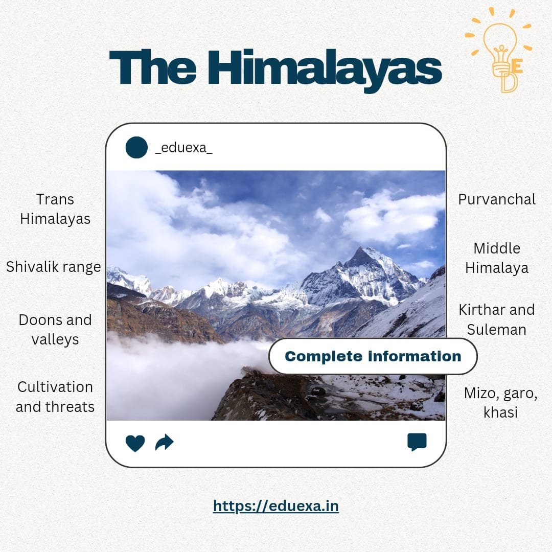
According to this study, Himalayas are divided into 4 parts from north to south.
Trans-Himalayas
These are composed of 4 mountain ranges
- Kailash ranges – Located completely in Tibetan Region. The most important and sacred mountain here is Mt Kailash. At the foothills of Kailash is Mansarovar.
- Karakoram ranges – These are northern most ranges of Himalayas. Highest peak here is K2.
- Ladakh range- Highest peaks here are Gasherbrum 1 and 2.
- Zaskar range – They extend southeastward for some 400 miles (640 km) from the Karcha (Suru) River to the upper Karnali River. Kamet Peak is the highest point, and the most important passes are Shipki, Lipu Lekh (Lipulieke), and Mana.
Important Plains – Aksai chin and soda plains
Important valleys- Nubra
Glaciers – Siachen, Baltora, biafo
Rivers- Indus
Great Himalayas (Himadri)
- These are a continuous chain of mountains extending from Nanga Parbat to Namcha Barua for a stretch of 2400 kms.
- Most of the highest peaks are located here. Some of the peaks include Mt Everest, Mt Kanchenjunga, Mt Makalu, Mt Manaslu etc.
- At the extremes of the Himalayas, the mountains have a bend called a syntaxial bend. In the western end leading to 2 ranges – Kirthar and Suleiman and towards the east leading to Peru yoma and Arkan Yoma.
Middle Himalayas (Himachal)
- These are located between greater Himalayas and shivaliks.
- They are highly polluted ranges
- All the major hill stations are restricted here. Ex- Darjeeling, Kullu, Manali, Dalhousie etc.
- It consists for 5 broken hill ranges- Pir panjal, Dhauladhar, Kumaon, Gahrwal and Mahabharat ranges.
Outer Himalayas (Shivalik)
- Average height of the mountains is between 700-1500m.
- They are low lying hills.
Cross sectional study
Kashmir Himalayas
Important peaks- K2, Gasherbrum 1 and 2
Important Passes
| Passes | Banihal, Zojila pass, Burzil pass | Leh pass, Khardungla pass |
| State/UT | Jammu and Kashmir | Ladakh |
Important duns – Jammu doon, Patli doon
Formation of mergs is important feature here- ex- Sonmarg, gulmarg
Rivers flowing – Indus and its tributaries
Lakes located here- Dal lake, Wular lake, Tso moriri, Tang Pang Tso
Important cultivation – Apple, Saffron, Peaches, Berries etc.
Uttarakhand Himalayas
They extend between Sutlej and Kali for about 320 km.
Important duns- Dehradun
Important Passes
| Passes | Niti pass, mana pass, lipulekh pass | Shipki la, rohtang, baralacha pass |
| States | Uttarakhand | Himachal Pradesh |
Important hot springs- Manikaran, Jwala Mukhi
Lakes present – Renukatal, Chandratal, nainital
Valleys – Valley of flowers (Uttarakhand), Lahaul spiti valley (HP)
Nomadic groups present here- Bhotiyas and Bhugiyal
Nepal Himalayas
These Himalayas extend between Kali to Teesta for about 800 km. Nepal is located in these ranges hence its name.
Tallest peaks like Mt Everest, Mt Makalu, Mt Annapoorna etc are located here.
Here the eastern part us dominated by tea plantations and western by horticulture plantation.
Assam Himalayas
They extend between Teesta river and Dihang river for about 700 kms.
Important feature include duar formation
Important peaks- Kanchenjunga
Important Passes –
- Nathu la pass, Jelep la pass – Sikkim
- Bum la, Bomdi la, Tawang, Tunga, Diphu, Yangyap – Arunachal Pradesh
Important cultivation – Tea
Assam Himalayas are further divided into 2 sets of Himalayas – Poorvanchal and Shivaliks.
- Poorvanchal range includes Mizo hills, Patkai Bhum, Naga hills, Manipur hills, Tripura hills, Khasi, Garo, Jaintia, Rengma and Mikir hills and Buril ranges.
- Shivalik ranges includes Miri hills, mishmi hills, Abhor hills, and Dafla hills.


Pingback: Unveiling the Assam Himalayas: Essential Passes & Classification
Pingback: A Guide to Aeolian Landforms: Formation, Types, and Impact